Weskeag
South Thomaston
Jump to
Guidelines
What You Need to Know
- No camping permitted
- No fires permitted
- Carry out all trash (see details)
- Keep pets under control (leash rules below)
- Respect privacy of preserve neighbors
Why we Care
A Coastal Haven
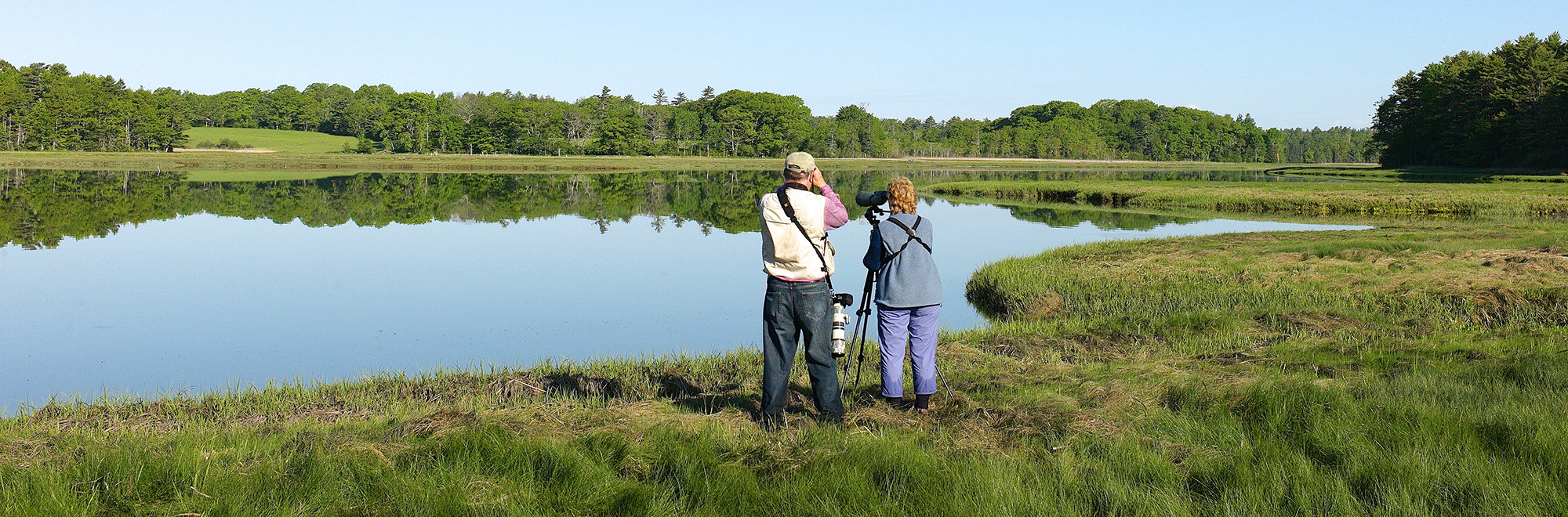
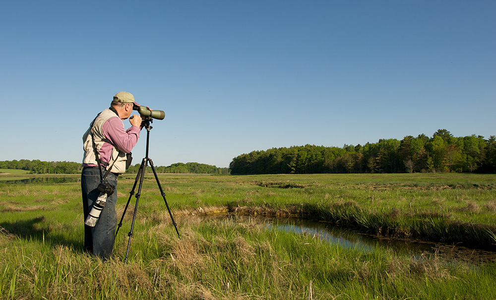
Stroll the pleasant 1-mile trail around Buttermilk Road hayfields to the edge of the marsh, and you’ll spot a diverse array of bird species drawn to the preserve. This same open landscape welcomes cross-country skiers and snowshoers in the winter and attracts white-tailed deer for hunting. Weskeag is more than a scenic preserve—it’s a vital habitat we’re proud to protect.
Features
How to Get There
From South Thomaston village, drive 0.6 miles north on Route 73, turn onto Buttermilk Road, and follow 0.7 miles to the main parking and trailhead. The southern section is accessed via Bartlett Lane, 0.5 miles north of the village. Its small lot is mostly for staff, and there are no trails on this side.
Explore the Map
View this preserve’s trails and features on the interactive map or download a printable copy above.
Preserve Details
Property:
Town:
County:
Accessible:
Field Notes
Getting to Know Weskeag
The Path to Conservation
MCHT acquired the preserve in 2018 with funding from the Land for Maine’s Future Program (LMF) and a National Coastal Wetland Conservation Grant from the US Fish and Wildlife Service (USFWS).
On the Preserve
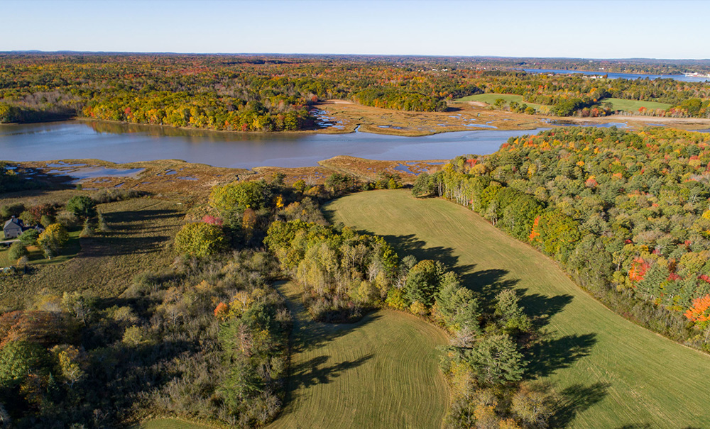
The preserve features a mixed hardwood and conifer forest, shrubland, and two fields maintained through annual, late-summer mowing for hay production. Wetlands are also abundant across the preserve, encompassing roughly 46 acres and including forested, shrub, and emergent marsh wetlands.
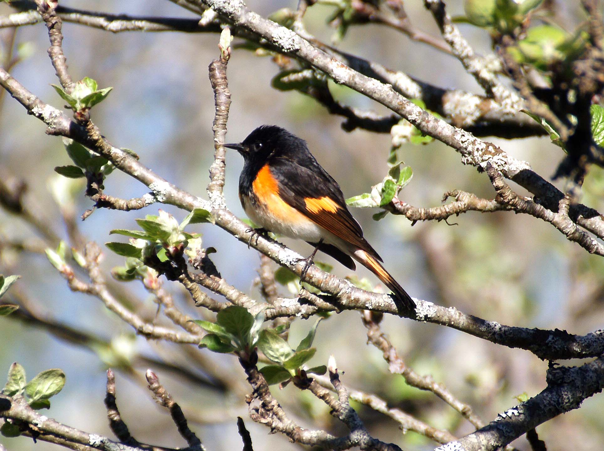
Wildlife abounds, including white-tailed deer, coyote, and significant bird and pollinator diversity. Bobolinks are often seen in both the Bartlett and Buttermilk hayfields. The Maine Department of Inland Fisheries and Wildlife has mapped Significant Wildlife Habitat for shorebirds, tidal wading birds, and waterfowl along the western section of the preserve, in a band roughly paralleling the tidal Weskeag River.
Be part of the movement

Contribute to a future with
healthy, open lands & waters
Donate Now

Give your time to help
care for the coast
Volunteer Now

Be a champion
for conservation
Spread the Word
More Information on Weskeag
Sharing the Preserve
We love dogs, but please keep them leashed from May 1 to August 15 to protect the nesting bobolinks who call Weskeag home.
Hunting on the Preserve
While hunting the white-tailed deer on Weskeag is permitted, please contact MCHT before setting up a deer stand.
Help Us Take Care of the Preserve
This preserve belongs to all of us; that’s why it’s important to leave as little trace as possible when you visit.
To do that, please:
- Carry out all trash
- Carry out all pet waste
- Carry out all human waste (including toilet paper)