Noah’s Ballast
Swan’s Island
Jump to
Guidelines
What You Need to Know
- No camping permitted
- No fires permitted
- Carry out all trash (see details)
- Keep pets under control
- Respect privacy of preserve neighbors
- Please leave no trace
Why we Care
A Hike Through Time
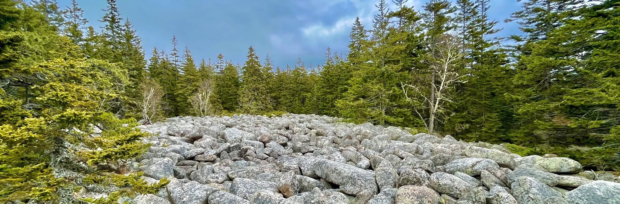
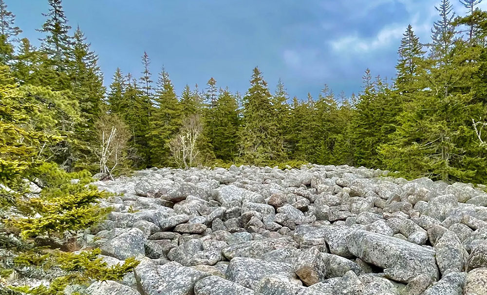
More than just a scenic landscape, Noah’s Ballast is a piece of ancient geological history we’re proud to protect. Head out for a day of exploring on the 1.5-mile hiking trail that visits scenic Goose Pond and features stunning ocean vistas before reaching the ancient boulder beach at the summit. This unique collection of boulders, formed after the peak of the last major Ice Age, has drawn visitors for decades.
Features
How to Get There
To get to Noah’s Ballast, take the ferry from Bass Harbor to Swan’s Island. Drive to the parking area and kiosk on Goose Pond Road (see below for complete directions). The road continues for roughly one mile to the trailhead (just before the pond), but this section is rough, prone to washouts, and not ideal for cars. The preserve is located at the summit of Goose Pond Mountain, at the end of the 0.7-mile blue-blazed hiking trail.
Explore the Map
Click on trails and landmarks to learn more about what Noah’s Ballast has to offer.
Preserve Details
Property:
Town:
County:
Accessible:
Field Notes
Getting to Know Noah’s Ballast
The Path to Conservation
After working with the Swan’s Island Community, MCHT acquired Noah’s Ballast along with a deeded right of way in 2022.
On the Preserve
The Noah’s Ballast Preserve is a 10-acre parcel on Swan’s Island, Hancock County. It is named for its main attraction, an ancient boulder beach which formed after the last glaciation when relative sea level was at its post-glacial maximum. Goose Pond Mountain would have been a very small island at the time, just above sea level. Most of Swan’s Island would have been submerged during this period. High-energy waves washed away the finer-grained sediment from among the boulders and rolled them around to create the rounded shapes you see today. There are other raised boulder beaches in the region at around 230 feet of elevation above current sea level.
The boulder field is surrounded by a stand of red pine to the northeast, and pitch pine forest to the southwest. The preserve is surrounded by undeveloped forest land, and long-used community trails cross private land to access it. There are no structures or other indications of previous development or human land use, other than social trails that wind through the forest to reach the boulder field.
The Noah’s Ballast Hike
From the northeastern shore of Goose Pond, follow the trail as it winds southeast and climbs to scenic ocean views toward John’s Island. Continue a little further to reach the preserve’s expansive boulder field. To exit, retrace your steps and avoid the unmaintained route leading east through private lands.
Stories from Mount Desert Island
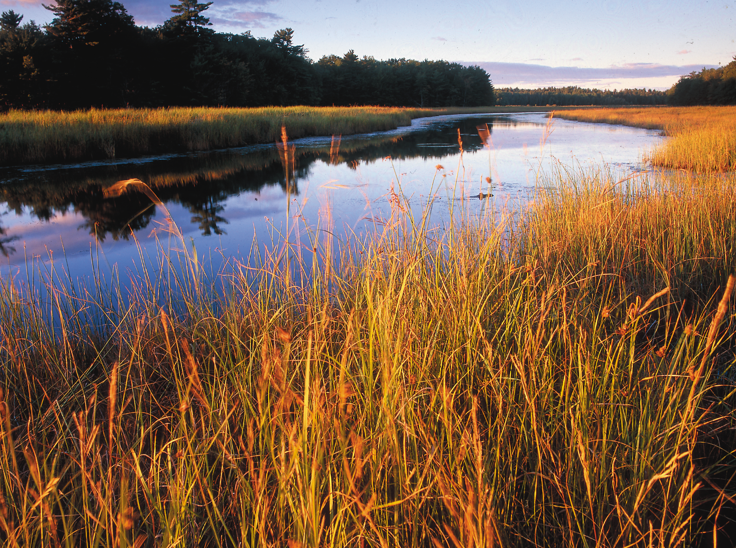
How We’re Restoring Marshes
Many tidal marshes in Maine aren’t working the way they’re supposed to, but through restoration we can improve chances of successful marsh migration as sea levels rise in the decades to come.
Be part of the movement

Contribute to a future with
healthy, open lands & waters
Donate Now

Give your time to help
care for the coast
Volunteer Now

Be a champion
for conservation
Spread the Word
More Information on Noah’s Ballast
Get There From Here
The preserve kiosk recommended parking area is approximately 1.8 miles from the ferry terminal.
- From the ferry terminal, drive south on ferry road for 0.6 miles.
- Turn right onto Atlantic Road. follow it for 0.6 miles.
- Turn left onto Goose Pond Road.
- After 0.5 miles, take a sharp right to remain on Goose Pond Road.
- The parking area and kiosk will be visible in 0.1 miles.
Help Us Take Care of the Preserve
This preserve belongs to all of us; that’s why it’s important to leave as little trace as possible when you visit.
To do that, please:
- Carry out all trash
- Carry out all pet waste
- Carry out all human waste (including toilet paper)