Malaga Island Preserve
Phippsburg
Jump to
Guidelines
What You Need to Know
- No camping permitted
- No fires permitted
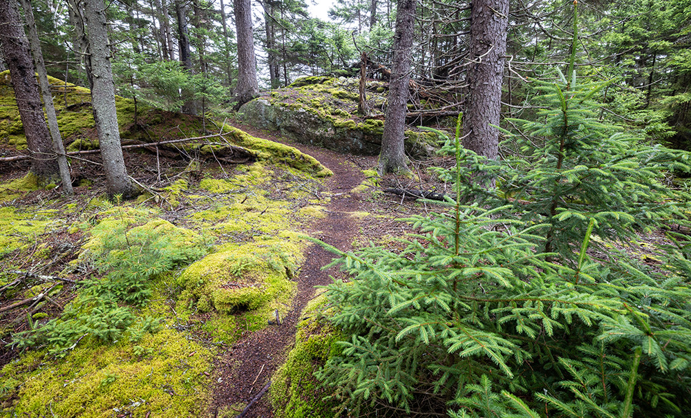
- Stay on established trails
- Carry out all trash (see details)
- Keep pets under control
- Do not disturb fishing gear
- Do not remove archaeological artifacts
Why we Care
Steeped in History
Malaga Island is more than a scenic preserve—it’s a living archive of perseverance. Protecting its wild beauty—from red spruce forests and endangered spotted wintergreen to great blue heron and nesting bald eagles— honors the stories etched into every stone and shoreline. This care is essential to keeping the island a place for exploration and reflection for years to come.
Features
How to Get There
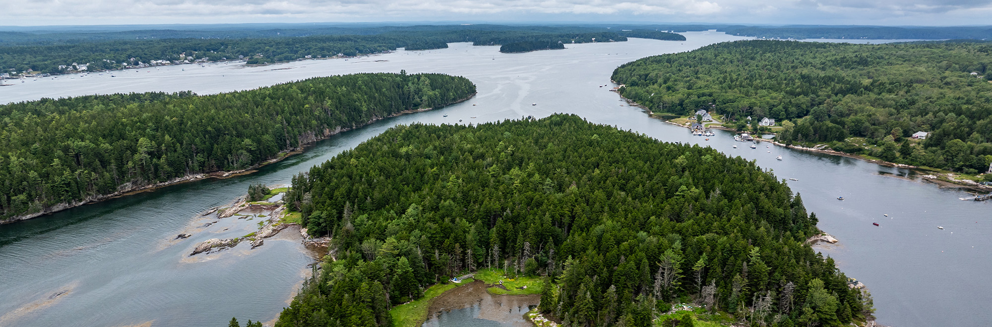
Malaga Island sits near the mouth of the New Meadows River in Phippsburg. The closest public boat launch is Holbrook Street Landing in Cundy’s Harbor, with three parking spots. There’s more spots at the launch at Sawyer Park Boat Ramp in Brunswick. Boaters can also use the Bethel Point Ramp in Harpswell for a small fee.
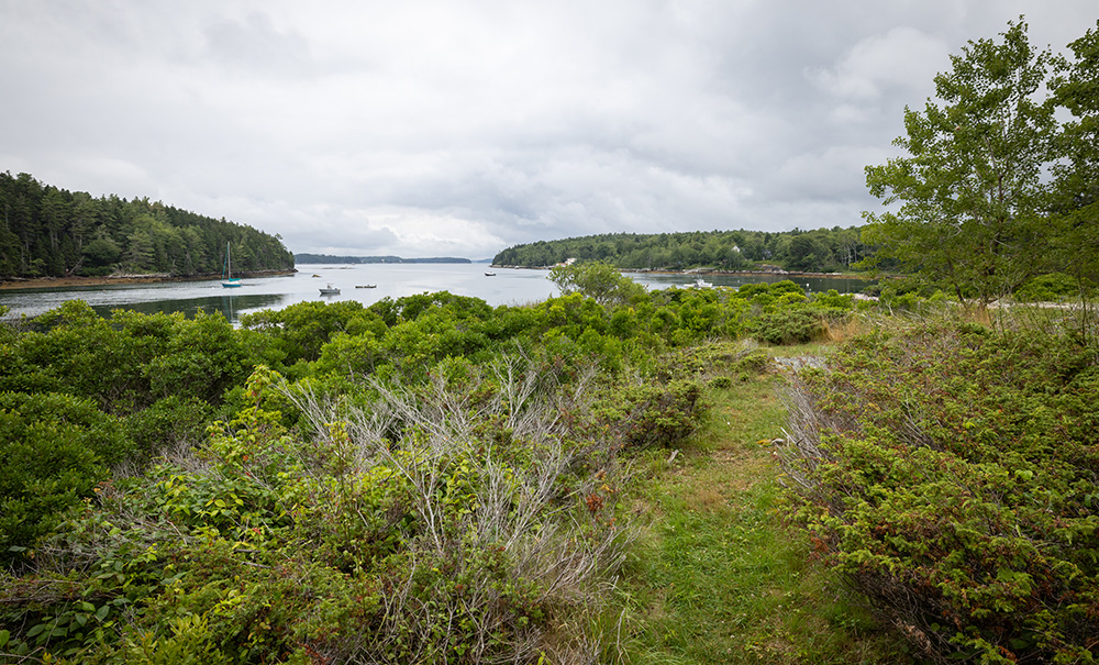
The best landing area is on the white shell beach on the island’s north end. A 10’x20’ float and ramp is seasonally available at the northwest corner of Malaga. The float is suitable for one boat to tie-up on; please drop-off passengers and anchor just north of the island in the mooring field. Be mindful of sharing the float with other visitors. All moorings are private.
Explore the Map
View this preserve’s trails and features on the interactive map or download a printable copy above.
Preserve Details
Property:
Town:
County:
Accessible:
LOOKING BACK, TO LOOK AHEAD
Malaga Island’s Story
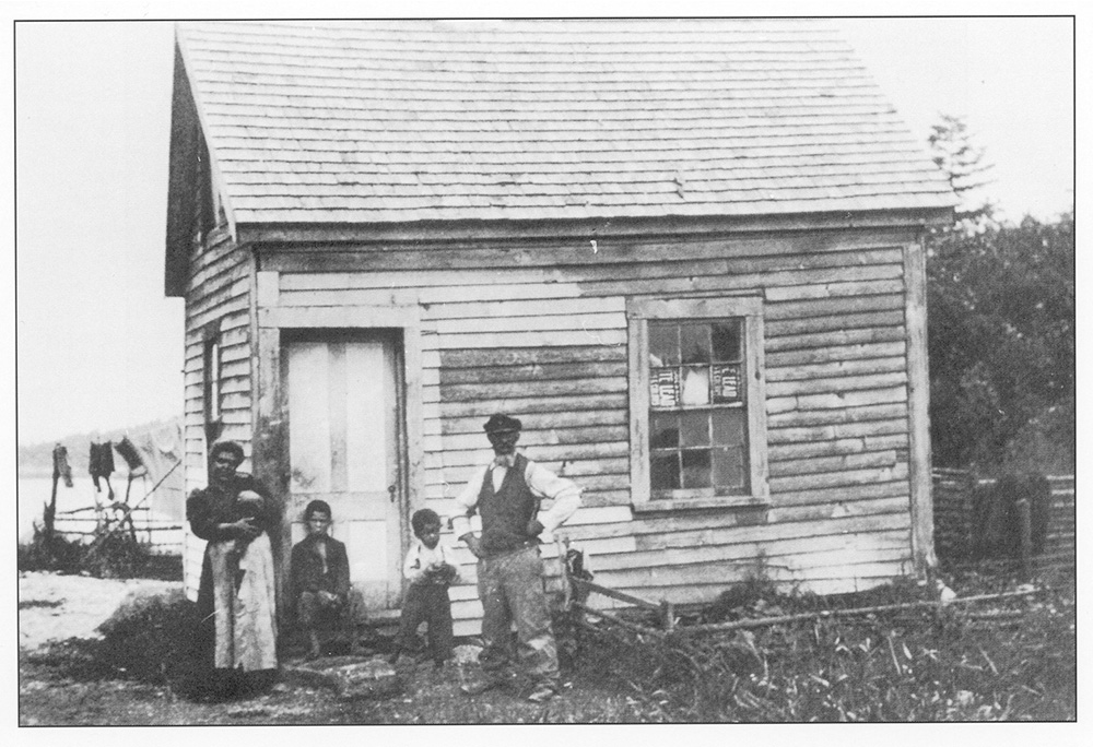
Malaga Island was home to a resilient mixed-race community from the mid-1800s to 1912. That year, amid rising economic pressure underscored by deep racial prejudice, the state of Maine forcibly evicted the residents, separated families, and erased much of what remained.
“I think the best plan would be to burn down the shacks with all of their filth,” then Governor Frederick Plaisted told a reporter at the time.
Nearly 100 years after this cruel act took place, in 2010, Maine’s then-Governor John Baldacci issued an apology, and the Maine legislature passed a resolution expressing its “profound regret.”
Since acquiring Malaga Island in 2001, MCHT has worked diligently to protect it as both a cultural and ecological preserve—efforts that led to its addition to the National Register of Historic Places in 2023. Today, through low-impact recreation, ongoing archaeological research, and traditional use by local fishermen, Malaga Island continues to thrive as a natural habitat and focal point for reflection and repair.


STORIES from Southern Maine
Nature Connects: A River that Feels like Home
Learn how the Presumpscot River in Southern Maine shaped one young person, and why it’s worth protecting.
Be part of the movement

Contribute to a future with
healthy, open lands & waters
Donate Now

Give your time to help
care for the coast
Volunteer Now

Be a champion
for conservation
Spread the Word
More Information on Malaga Island
Learn More Before You Visit
Since acquiring the island, MCHT has worked with various partners, including the University of Southern Maine, to better understand the island’s archaeological history and to help share this forgotten chapter of Maine’s history.
Deepen your connection to Malaga Island and its history by exploring these helpful resources:
- Re:Past, curated by Myron M. Beasley in 2019
- Self-Guided Tour of Malaga Island Preserve (PDF)
- Archeology of Malaga Island (Video)
- “The Legacy of Malaga Island and the Limits of Maine’s Progressivism”
- “On island beauty, a buried story of how Maine exiled a thriving fishing village” Spectrum News Story and Video – Part 1
- “On island beauty, a buried story of how Maine exiled a thriving fishing village” Spectrum News Story and Video – Part 2
On the island, you’ll find more information at the kiosk.
The Story Behind the Lobster Traps
The long-time practice of nearby lobstermen storing traps and fishing gear on the island has continued under our ownership. Please do not disturb the gear, but feel free to order the local catch at nearby stores and restaurants.
Get the Lay of the Land
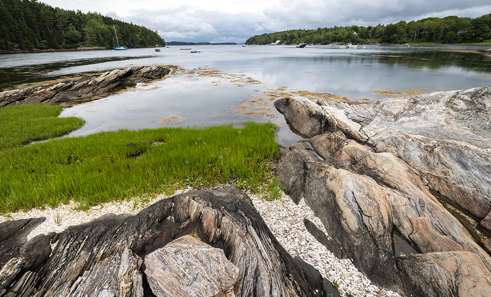
Most of the 42-acre Malaga Island Preserve is covered in maritime spruce-fir, with one to two acres of meadow at the northern end. The southern end features a brackish pond and small patches of salt marsh. The shoreline is mostly rocky and rugged, with a few small beaches and salt marsh areas scattered throughout.
Watch for poison ivy: Found mostly in the northern section and along some shoreline patches. It’s easy to avoid if you stay on the trail.
Find a Guide
- Seaspray Kayaking
Located in nearby Sebasco Harbor, they have been guiding sea kayaking expeditions in the area for over 20 years. - Alice’s Awesome Adventures
Just for you, tailored tours of Malaga Island and Midcoast Maine led by Master Maine Guide Alice Bean Andrenyak.
Help Us Take Care of the Preserve
This preserve belongs to all of us; that’s why it’s important to leave as little trace as possible when you visit.
To do that, please:
- Carry out all trash
- Carry out all pet waste
- Carry out all human waste (including toilet paper)